Published :
Updated :
 For all latest news, follow The Financial Express Google News channel.
China and India are moving to share satellite data involving natural disaster relief, at a time when the South Asian nation is under pressure to find long-term solutions to its frequent flood woes.
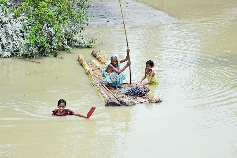
More than 150 people died and millions more suffered after flooding and landslides ravaged several parts of India. Every year, India's June-September monsoon delivers heavy rains, regularly resulting in deadly flooding. China is willing to lend a hand to India to solve this longstanding problem, even though the road for promoting cutting-edge technology links with India is always bumpy due to complex geopolitical issues.
Satellite-related cooperation is always a sensitive bilateral topic, with concerns expressed by some Indian observers over national security.
However, such worries are unnecessary. On July 17, India sought international support in accordance with the International Charter on Space and Major Disasters, a multilateral mechanism aimed at sharing clear space-based data for countries affected by natural or man-made disasters.
China, which signed onto the charter in 2007, responded rapidly to India's request by sharing images of flood-stricken regions in India taken by Chinese satellites.
China has gained ground in the race to the forefront of a spate of cutting-edge technologies, ranging from space to bioscience. For instance, 11 years after a deadly earthquake ravaged Southwest China, the country has mastered advanced technologies in earthquake monitoring and launched a sound earthquake prediction project in that part of the nation.
Now the two countries have large potential for cooperation, in which China's possession of cutting-edge technologies can be instrumental for India's disaster relief.
China is willing to tap the potential for cutting-edge technology cooperation between the two countries.
What is important is how to persuade ordinary Indian people, the biggest beneficiaries of this cooperation, in a bid to win widespread support in Indian society.
China has so far supported disaster relief efforts by using its satellites for more than 30 countries and regions, some of which are located along the routes of the Belt and Road Initiative (BRI). The initiative is designed to be a platform to bring tangible benefits to ordinary people.
Even though New Delhi till today refuses to endorse the BRI, the sharing of satellite data will help Indian people gain a better understanding of the motive of the initiative and leave the door open for more cooperation.