Published :
Updated :
 For all latest news, follow The Financial Express Google News channel.
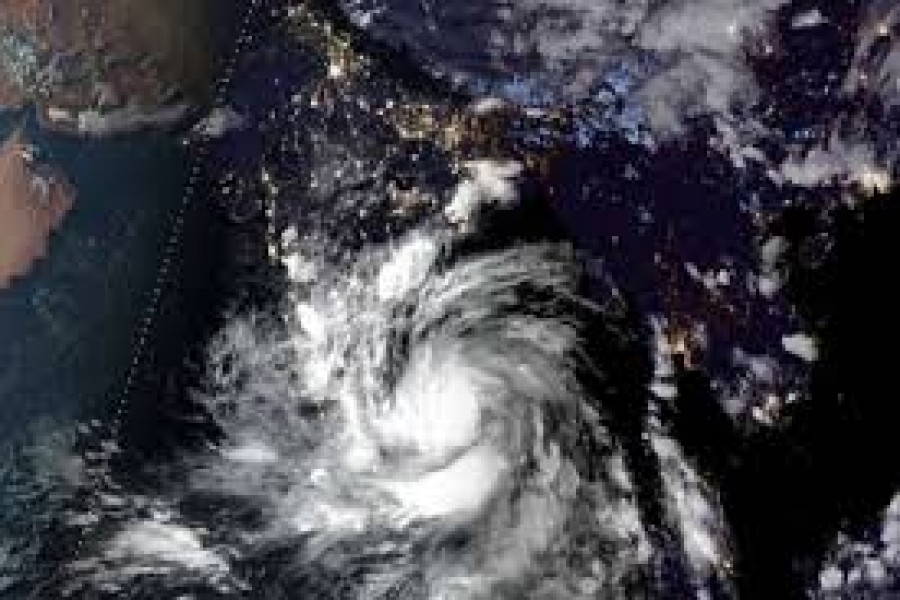
The Bangladesh Meteorological Department has advised maritime ports to hoist local cautionary signal No. 4 as a trough of low over the Bay of Bengal intensified and turned into a deep depression on Thursday, reports bdnews24.com
The Met Office has forecast heavy to very heavy rains at different places over Rajshahi, Dhaka, Khulna, Barishal, Chattogram, Mymensingh and Sylhet divisions due to the well-marked low over the northwest bay and adjoining west-central bay.
The trough of low intensified into a deep depression in the next three-hour phase over the north-west Bay and adjoining area and moved northwards, meteorologist Abul Kalam Mallik said.
But the Met Office could not immediately indicate whether the depression will turn into a cyclone or chart its projected path.
The depression which formed over the central part of the Bay of Bengal is situated over north-west and the adjoining area. It is likely to intensify further and move in a northerly direction, meteorologist Shahnaz Sultana said.
Fishing boats and trawlers in the north Bay of Bengal and the deep sea have also been asked to remain near the coast and remain cautious until further notice.
“The Met Office has asked the maritime ports of Chattogram, Cox’s Bazar, Mongla and Payra to hoist the local cautionary signal number 4. Different parts of the country are experiencing light to moderate rains due to the low. Heavy to very heavy rains will also continue,” Mallik said, adding the Met Office will issue an update on the situation either on Oct 23 or Oct 24.
Some 202mm rainfall was recorded in Patuakhali's Khepupara within 24 hours and 24mm in Dhaka, the Met Office added.
A low-pressure area had initially formed over the Bay of Bengal on Oct 10. Another one followed within three weeks, raising concerns that it could transform into a cyclone.
It is likely to intensify and move northwest, according to said. A cyclonic storm may develop from the low pressure and its course will be revealed later.
The next cyclonic storm in the region will be named ‘Goti’. A panel of WMO/ESCAP or World Meteorological Organisation/United Nations Economic and Social Commission for Asia and the Pacific name the cyclones in the region in line with a list prepared by 13 member countries.