Published :
Updated :
 For all latest news, follow The Financial Express Google News channel.
The world experiences millions of earthquakes each year. But not many can be felt because of their low intensity or small magnitude. The magnitude measures the energy released by an earthquake and is generally based on the well-known Richter scale. Intensity, on the other hand, measures the extent of damage caused by it through the Modified Mercalli Intensity (MMI) Scale based on observed effects like ground-shaking and damage to buildings.
Generally, a few catastrophic earthquakes occur each year, such as the one in Turkey in August 1999, the Indian Ocean Earthquake cum Tsunami of December 2004, and the Haiti Earthquake of January 2010. Besides, approximately 10 large quakes like the one in Taiwan (September 1999), and around 100 moderate quakes also occur, which serve as wake-up calls for people living in earthquake zones. The danger is greatest for those living in old masonry buildings not built according to modern earthquake standards, which is true for most buildings in Bangladesh. For those living on alluvium or river flood-plains as in Bangladesh, the danger is magnified many times. The alluvium acts like a liquid and develops large waves similar to swells on a tumultuous ocean.
It is now a well-established fact that the sliding movement of the earth's plates, which form the outer and inner shells of the earth's crust, cause the earthquakes. Bangladesh is situated in one such risky location. The country stands on the Bengal basin, which is one of the most seismically active zones in the world. The land is extremely prone to earthquakes due to its location in the confluence of India, Burma, and Eurasia Plates. The seismic fault-line of these plates have run from Afghanistan, and extended up to Myanmar via Pakistan, India, and Bangladesh. As a result, this region has experienced some of the worst earthquakes in history.
In 1993, ten thousand people died in a major earthquake that shook the Indian state of Maharashtra. Another catastrophic earthquake struck Afghanistan in 1998. Besides, many people have also died due to minor earthquakes in India, Pakistan, and Bangladesh during the past few decades. The earthquake originating at Bandarban (magnitude 6.1 in the Richter Scale) in November 1997 caused at least 23 deaths; and the one in Maheshkhali in the Bay of Bengal dismantled most of the residential structures on that island in July 1999. These were followed by the Barkal (Rangamati) Earthquake of 2003, and the Mymensingh and Chandpur Earthquakes of 2008.
The latest in this series of low to moderate intensity earthquakes in Bangladesh was the one that struck the country at 10.38 am on November 21 2025 and lasted for 20 seconds. Its magnitude was 5.7 in the Richter Scale, and its epicentre was 10 kilometres below the ground at Madhabdi of Narsingdi district - about 25 kilometres away on the northeast of capital Dhaka. At least 11 people died due to its impact including collapse, cracking, and tilting of buildings and walls at Narsingdi, Dhaka, Narayanganj, and Gazipur. Besides, over 300 people were injured at various places of the country owing to its impact.
The Narsingdi Earthquake originated at a depth of 10 kilometres at the convergence of two tectonic plates that runs via Sunamganj, the marshlands of Kishoreganj, and the Meghna River up to the Bay of Bengal. The convergence of these two plates is called subduction zone, which implies one of the plates sliding below the other and sinking into the earth's mantle. This subduction zone extends from Sylhet to the hilly areas of Cox's Bazar. The junction of these plates has been accumulating energy over a period of 800 to 1000 years, which can cause earthquakes of magnitude 8.2 to 9 on the Richter Scale. The latest quake at Narsigndi indicates that a small fragment of that energy was unlocked, which would make the subsequent eruption easier. Consequently, the probability of a major earthquake hitting Bangladesh in the not-too-distant future has increased. Besides, another quake of moderate intensity may also hit the country soon as an aftershock of the previous one.
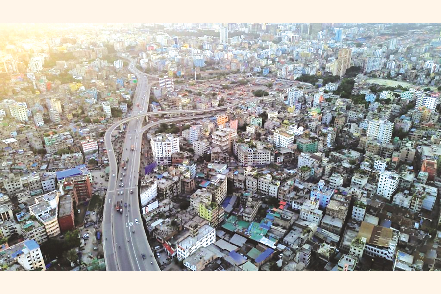
Some experts opine that there is a strong possibility of a major earthquake hitting Bangladesh from now to 2030. But people do not seem to be much aware or concerned about it due to its negligible incidence and impact over a long period. The government also seems to be lacking in preparedness for any such eventuality. According to some experts, only 10 to 15 per cent of the buildings in Dhaka would survive if a major earthquake strikes.
Over one hundred years have elapsed since the last major earthquake - the Bengal Earthquake of 14 July 1885 - struck Bangladesh, whose magnitude was 7.1 on the Richter scale and which caused extensive damage in Sirajganj, Bogra, Jamalpur, Sherpur, and Mymensingh regions. This was followed by the 'Great Indian Earthquake' of June 1897, which was one of the most powerful and destructive in recorded history with a magnitude of 8.7 on the Richter Scale; it originated in the western part of the Shillong Plateau due to reactivation of the Dauki Fault. After that occurred the Srimangal Earthquake of 1918 (7.6), the Meghalaya Earthquake of 1923 (7.1), The Dhubri Earthquake of 1930 (7.1), and the Assam Earthquakes of 1943 ((7.2) and 1950 (8.4). The seismic energy that is required to cause another such major earthquake has already formed below the geological structure of Bangladesh. Thus, a major earthquake is possible any time.
Researchers apprehend that in the event of a major quake, the situation in Dhaka may turn catastrophic. An expert on the subject - the late professor Dr. Jamilur Reza Chowdhury of BUET had claimed that only 10 to 15 per cent buildings in Dhaka would survive in case of such an eventuality. This is because, most of the buildings in the metropolis have not been constructed in conformity with the Building Code, and their quality is also very poor in most cases.
The government also does not appear to be focusing much on the probable scenario and its catastrophic impact. Late Dr Chowdhury had also cautioned about lack of preparedness in Bangladesh for tackling the aftermath of any major earthquake including rescue operations. The Gas, Water, and Electricity departments are not prepared for such an eventuality. And the ordinary people appear to nurture a blind faith that no such disaster would occur. But on close examination, it is found that Dhaka, Bogura, Sylhet, Rangpur, Mymensingh, and Chatogram regions are quite susceptible to the occurrence of a major earthquake.
According to the vulnerability zoning maps, Bangladesh is at present divided into three zones that are highly fractured and faulted across and parallel to their lengths. Zone-1, encompassing Rangpur, Mymensingh and Sylhet regions, is the most vulnerable one. Zone 2, which cuts through the middle of the country, and includes Dhaka, Chattogram, Dinajpur, Bogura and Tangail is almost equally vulnerable. Zone-3, comprising the southern belt is considered less risky. However, being part of an active region, no part of the country is fully safe.
According to experts, most buildings in the cities of Dhaka and Chattogram may be reduced to rubble if they are hit by a major earthquake; this is because most builders have not bothered to follow building codes and use proper construction materials. The aftermath of such a quake would be catastrophic, as the country still lacks adequate capability to respond to such an event. The utilities like electricity, water and gas would be badly affected when an earthquake strikes, and may themselves become serious threats to life, property, and resources. If the capacity of the response mechanism is poor, such vulnerability may assume the shape of a mega-hazard. Many lives can, however, be saved if timely actions are now taken before a major earthquake strikes the country.
Dr Helal Uddin Ahmed is a retired Additional Secretary and former Editor of Bangladesh Quarterly. Email: hahmed1960@gmail.com