Indonesia stay on alert after magnitude 6.2 quake hits Sumatra

Published :
Updated :

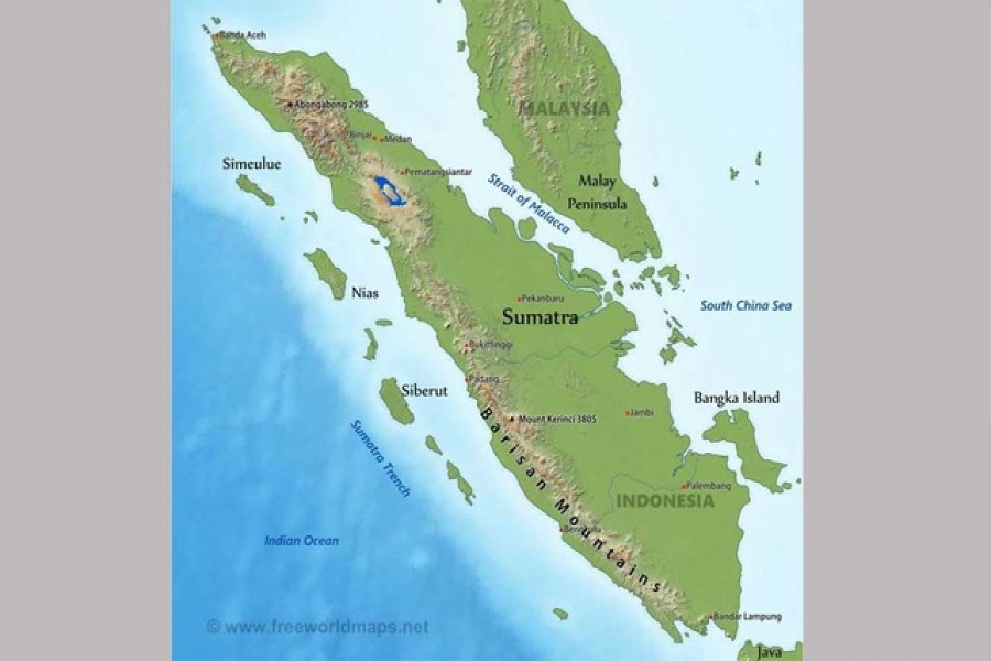
A magnitude 6.2 earthquake struck the near the western coast of Indonesia's Sumatra island on Friday, the country's geophysics agency BMKG said, though there was no risk of a tsunami or immediate reports of major damage, Reuters reports.
The quake, which was on land at a depth of 10 km (6.21 miles), was felt as far away as Singapore and Malaysia and strongly in the nearby cities of Padang in West Sumatra province and in Pekanbaru in Riau Province, witnesses said.
"We continue to monitor and advise people to remain on alert," Dwikorita Karnawati, the head of BMKG, told MetroTV.
"Because this is on land, and the scale is above 6, we are concerned that it could cause some damage."
In Pasaman Barat, about 17 km from the epicentre, a witness told MetroTV patients in a hospital were evacuated from the building.
Indonesia's disaster mitigation agency could not immediately be reached for comment about damage.
Indonesia suffers frequent earthquakes, straddling the so-called "Pacific Ring of Fire", a highly seismically active zone, where different plates on the earth’s crust meets.
Last month, a 6.6-magnitude earthquake struck off Java island, prompting some residents in the capital Jakarta to flee from buildings in panic.
A more powerful 7.4 magnitude in Flores Sea triggered a tsunami warning in December, though caused only minor damage.


 For all latest news, follow The Financial Express Google News channel.